
Mapa topográfico Oud Annerveen
Mapa interactivo
Haga clic en el mapa para ver la altitud.
Acerca de este mapa
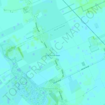
Nombre: Mapa topográfico Oud Annerveen, altitud, relieve.
Lugar: Oud Annerveen, Aa en Hunze, Drenthe, Nederland (53.07618 6.74511 53.09476 6.78875)
Altitud media: 2 m
Altitud mínima: -1 m
Altitud máxima: 5 m
Otros mapas topográficos
Haga clic en un mapa para ver su topografía, su altitud y su relieve.
Oosterbroek
Oosterbroek, Eelde, Tynaarlo, Drenthe, Nederland, 9761 TG, Nederland
Altitud media: 3 m
Oosterhesselen
Nederland > Drenthe > Coevorden
Oosterhesselen, Coevorden, Drenthe, Nederland
Altitud media: 15 m
Nieuw-Buinen
Nederland > Drenthe > Nieuw-Buinen
Nieuw-Buinen, Borger-Odoorn, Drenthe, Nederland
Altitud media: 7 m