
Mapa topográfico Braunwald
Mapa interactivo
Haga clic en el mapa para ver la altitud.
Braunwald
Braunwald is situated in the Glarus Alps on a terrace above the Linth valley, at an elevation of 1,256 meters (4,121 ft). It overlooks the villages of Linthal and Rüti in the valley below. It is overlooked by the mountains of Ortstock (2,717 m or 8,914 ft), Höch Turm (2,666 m or 8,747 ft), Eggstock (2,455 m or 8,054 ft) and Bös Fulen (2,802 m or 9,193 ft).
Acerca de este mapa
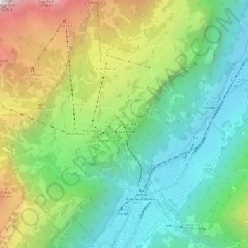
Nombre: Mapa topográfico Braunwald, altitud, relieve.
Lugar: Braunwald, Glarus Süd, Glarus, 8784, Switzerland (46.91926 8.97850 46.95926 9.01850)
Altitud media: 1 215 m
Altitud mínima: 588 m
Altitud máxima: 2 399 m
Otros mapas topográficos
Haga clic en un mapa para ver su topografía, su altitud y su relieve.