

Mapas topográficos Bas-Rhin
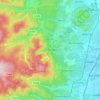
Haga clic en un mapa para ver su topografía, su altitud y su relieve.

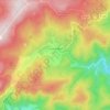
Le Hohwald
Le Hohwald is a hill village, with altitude above sea level in the commune ranging from 450 meters to nearly 1100 meters, positioned some fifty kilometres to the west-south-west of Strasbourg and some ten kilometres to the south-west of Mont Sainte-Odile. Its position in the lee of mountains protects it from…
Altitud media: 730 m













Acerca de este lugar
Niederbronn-les-Bains • Urbeis • Wissembourg • Wolxheim • Kirchheim • Saint-Martin • Belmont • Strasbourg • Diemeringen