
Mapa topográfico Former Chitrāl District
Mapa interactivo
Haga clic en el mapa para ver la altitud.
Acerca de este mapa
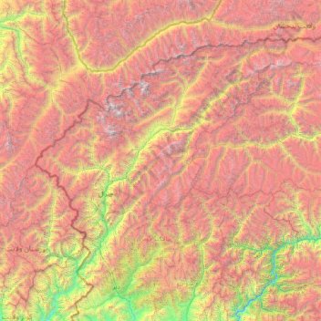
Nombre: Mapa topográfico Former Chitrāl District, altitud, relieve.
Lugar: Former Chitrāl District, Khyber Pakhtunkhwa, Pakistan (35.21630 71.19503 36.90879 73.88966)
Altitud media: 3 729 m
Altitud mínima: 841 m
Altitud máxima: 7 533 m
Chitral is connected to the rest of Pakistan by two major road routes, the Lowari Pass (el. 10,230 ft.) from Dir and Shandur Top (elevation 12,200 ft.) from Gilgit. Both routes used to be closed in winter, but circa 2017 the highway Lowari Tunnel under the Lowari Pass opened to vehicular traffic for at least ten hours per day. A number of other high passes, including Darkot Pass, Thoi Pass and Zagaran Pass, provide access on foot to Chitral from Gilgit-Baltistan.
Otros mapas topográficos
Haga clic en un mapa para ver su topografía, su altitud y su relieve.
Tutt
Pakistan > Khyber Pakhtunkhwa > Battagram District > Allai Tehsil
Tutt, Allai Tehsil, Battagram District, Hazara Division, Khyber Pakhtunkhwa, Pakistan
Altitud media: 2 231 m
Saro Kaly
Pakistan > Khyber Pakhtunkhwa > Saro Kaly
Saro Kaly, Khyber Pakhtunkhwa, Pakistan
Altitud media: 348 m
Swat
Pakistan > Khyber Pakhtunkhwa > Abazai > Gul Bagh
Swat, Gul Bagh, Abazai, Khyber Pakhtunkhwa, Pakistan
Altitud media: 370 m
Sirikot
Pakistan > Khyber Pakhtunkhwa > Sirikot
Sirikot, Khyber Pakhtunkhwa, 22840, Pakistan
Altitud media: 882 m
Abbottabad
Pakistan > Khyber Pakhtunkhwa > Abbottabad
Abbottabad, Khyber Pakhtunkhwa, 22010, Pakistan
Altitud media: 1 365 m
Koyo Zom
Koyo Zom, Chitrāl District, Khyber Pakhtunkhwa, Pakistan
Altitud media: 5 925 m
Noshaq
Noshaq, Chitrāl District, Khyber Pakhtunkhwa, Pakistan
Altitud media: 6 856 m
Malakand
Pakistan > Khyber Pakhtunkhwa > Malakand
Malakand, Mardān District, Khyber Pakhtunkhwa, Pakistan
Altitud media: 787 m
Peshāwar District
Peshāwar District, Khyber Pakhtunkhwa, Pakistan
Altitud media: 684 m
Saraghrar I
Saraghrar I, Chitrāl District, Khyber Pakhtunkhwa, Pakistan
Altitud media: 6 780 m
Buni Zom
Buni Zom, Chitrāl District, Khyber Pakhtunkhwa, Pakistan
Altitud media: 5 627 m
Istor-o-Nal
Istor-o-Nal, Chitrāl District, Khyber Pakhtunkhwa, Pakistan
Altitud media: 6 853 m
Chitral
Pakistan > Khyber Pakhtunkhwa > Chitrāl District
Chitral, Chitral Tehsil, Lower Chitral District, Chitrāl District, Malakand Division, Khyber Pakhtunkhwa, Pakistan
Altitud media: 2 982 m
Khyber Agency
Khyber Agency, Peshawar Division, Khyber Pakhtunkhwa, Pakistan
Altitud media: 1 063 m