
Gracias por apoyar a este sitio ❤️
Haz una donación
Haz una donación
Mapa topográfico San Rafael
Haga clic en el mapa para ver la altitud.
Gracias por apoyar a este sitio ❤️
Haz una donación
Haz una donación
Acerca de este mapa
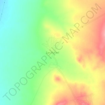
Nombre: Mapa topográfico San Rafael, altitud, relieve.
Lugar: San Rafael, Villa de Ramos, San Luis Potosí, México (23.00212 -101.96460 23.04212 -101.92460)
Altitud media: 2 157 m
Altitud mínima: 2 110 m
Altitud máxima: 2 211 m
Gracias por apoyar a este sitio ❤️
Haz una donación
Haz una donación