
Haz una donación
Mapa topográfico Hudson
Haga clic en el mapa para ver la altitud.
Haz una donación
Hudson
Hudson features a predominantly flat and low-lying topography typical of the region, with an average elevation of approximately 16 feet above sea level. This terrain is interspersed with various wetlands and small lakes, creating a rich ecosystem that supports diverse wildlife. The area also includes a few gently rolling hills, but overall, the landscape is characterized by its proximity to the Gulf of Mexico, leading to sandy soils and coastal marshes. The nearby coastal environment contributes to the scenic beauty of Hudson, making it an appealing location for recreational activities like fishing and boating.
Haz una donación
Acerca de este mapa
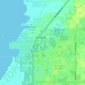
Nombre: Mapa topográfico Hudson, altitud, relieve.
Lugar: Hudson, Pasco County, Florida, 34667, United States (28.33816 -82.72364 28.37833 -82.65768)
Altitud media: 5 m
Altitud mínima: -1 m
Altitud máxima: 15 m
Haz una donación