
Mapa topográfico Mitlödi
Mapa interactivo
Haga clic en el mapa para ver la altitud.
Mitlödi
Mitlödi is located in the valley of the Linth river, on a pre-historic rock slide, at an elevation of 504 m (1,654 ft). It consists of the village of Mitlödi itself, and the separate section of Ennetlinth on the right bank of the Linth. The village of Schwanden lies upstream and to the south, whilst the town of Glarus is downstream and to the north.
Acerca de este mapa
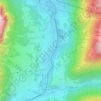
Nombre: Mapa topográfico Mitlödi, altitud, relieve.
Lugar: Mitlödi, Glarus Süd, Glarus, 8756, Switzerland (46.99147 9.05991 47.03147 9.09991)
Altitud media: 800 m
Altitud mínima: 481 m
Altitud máxima: 1 745 m