
Haz una donación
Mapa topográfico Brewster
Haga clic en el mapa para ver la altitud.
Haz una donación
Acerca de este mapa
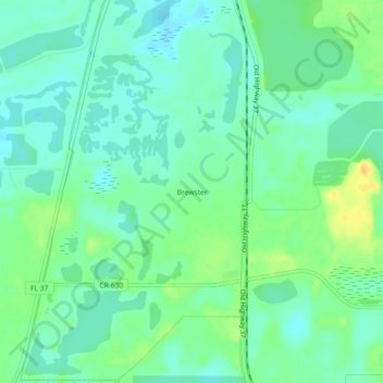
Nombre: Mapa topográfico Brewster, altitud, relieve.
Lugar: Brewster, Polk County, Florida, United States (27.73281 -81.99953 27.77281 -81.95953)
Altitud media: 42 m
Altitud mínima: 32 m
Altitud máxima: 62 m
Haz una donación
Otros mapas topográficos
Haga clic en un mapa para ver su topografía, su altitud y su relieve.
Haz una donación
Haz una donación
Colt Creek State Park
United States > Florida > Polk County
The park's habitat consist primarily of mesic flatwoods co-dominated by cypress domes, hardwood hammocks and wetlands. Lands within the park are relatively flat, with an average elevation of 90 feet above sea level. Additionally, natural-looking lakes that formed from old lime rock mining operations are…
Altitud media: 28 m
Haz una donación
Lakeland Highlands
United States > Florida > Polk County > Bartow > Lakeland Highlands
Altitud media: 64 m
Haz una donación
Haz una donación