
Mapa topográfico Uthind
Haga clic en el mapa para ver la altitud.
Acerca de este mapa
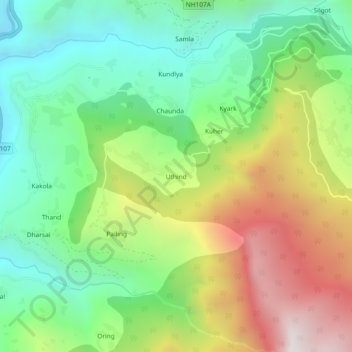
Nombre: Mapa topográfico Uthind, altitud, relieve.
Lugar: Uthind, Ukhimath, Rudraprayag, Uttarakhand, 246419, India (30.45730 79.08898 30.49730 79.12898)
Altitud media: 1 601 m
Altitud mínima: 967 m
Altitud máxima: 2 633 m
Otros mapas topográficos
Haga clic en un mapa para ver su topografía, su altitud y su relieve.