
Mapa topográfico Ingenbohl
Mapa interactivo
Haga clic en el mapa para ver la altitud.
Acerca de este mapa
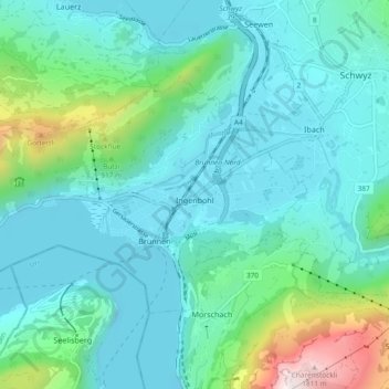
Nombre: Mapa topográfico Ingenbohl, altitud, relieve.
Lugar: Ingenbohl, Schwyz, 6440, Switzerland (46.98233 8.54903 47.02105 8.64196)
Altitud media: 674 m
Altitud mínima: 414 m
Altitud máxima: 1 893 m
Otros mapas topográficos
Haga clic en un mapa para ver su topografía, su altitud y su relieve.
Rickenbach
Switzerland > Schwyz > Schwyz > Schwyz
Rickenbach, Schwyz, 6432, Switzerland
Altitud media: 751 m