
Gracias por apoyar a este sitio ❤️
Haz una donación
Haz una donación
Mapa topográfico Dunsfold
Haga clic en el mapa para ver la altitud.
Gracias por apoyar a este sitio ❤️
Haz una donación
Haz una donación
Dunsfold
St Mary & All Saints' Church is a Norman building, containing the oldest pews in England. The nearby Holy Well was a site of pilgrimage – its waters were thought to cure diseases of the eye. It would be consistent with the topography of the site that the well be a pre-Christian site and the church itself be constructed on a man-made hill of pre-Christian origin. The current rector is Paul Jenkins who has been installed since 23 January 2007.
Gracias por apoyar a este sitio ❤️
Haz una donación
Haz una donación
Acerca de este mapa
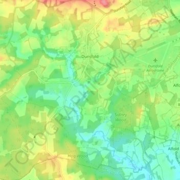
Nombre: Mapa topográfico Dunsfold, altitud, relieve.
Lugar: Dunsfold, Waverley, Surrey, England, United Kingdom (51.07974 -0.59781 51.13305 -0.53670)
Altitud media: 52 m
Altitud mínima: 22 m
Altitud máxima: 97 m
Gracias por apoyar a este sitio ❤️
Haz una donación
Haz una donación