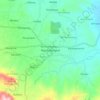
Mapa topográfico Pemalang
Haga clic en el mapa para ver la altitud.
Pemalang
The regency has a varied topography. The northern part of the regency is a coastal area with an altitude ranging from 1 to 5 metres above sea level. The central part is a fertile lowland with an altitude of 6 to 15 metres above sea level; and the southern highlands and mountains are lush with cool air at an altitude varying from 16 to 925 metres above sea level. The region is crossed by two major rivers – the Waluh River and the Comal River. Most of the region is a fertile watershed.
Acerca de este mapa

Nombre: Mapa topográfico Pemalang, altitud, relieve.
Lugar: Pemalang, Central Java, Java, Indonesia (-7.24889 109.18559 -6.77331 109.59920)
Altitud media: 295 m
Altitud mínima: -1 m
Altitud máxima: 3 408 m
Otros mapas topográficos
Haga clic en un mapa para ver su topografía, su altitud y su relieve.





Ungaran
Indonesia > Central Java > Kabupaten Semarang
Ungaran (Dutch: Oengaran) is a town and adjacent areas in Central Java Province of Indonesia. The town serves as the administrative centre of the Semarang Regency in that province. Ungaran is located at -7° 8' 17", 110° 24' 18" at an elevation of 319 metres. It encompasses two districts (kecamatan) within…
Altitud media: 399 m