
Gracias por apoyar a este sitio ❤️
Haz una donación
Haz una donación
Mapa topográfico Kalay
Haga clic en el mapa para ver la altitud.
Gracias por apoyar a este sitio ❤️
Haz una donación
Haz una donación
Kalay
Geographically, the distinctive feature of the town is that the Tropic of Cancer passes through it. This point has been marked by the milepost 55/56 near Kyansitgon village. Set in terrain that has an average elevation of 450 feet (140 m) above mean sea level, the town has a picturesque backdrop of the Laytha Hill in the east and the Chin Hills in the west.
Gracias por apoyar a este sitio ❤️
Haz una donación
Haz una donación
Acerca de este mapa
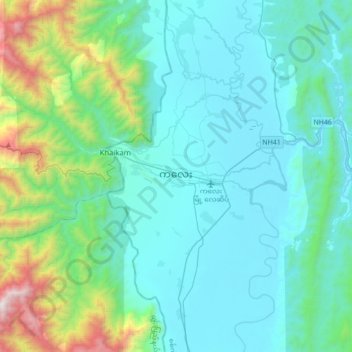
Nombre: Mapa topográfico Kalay, altitud, relieve.
Altitud media: 419 m
Altitud mínima: 96 m
Altitud máxima: 2 140 m
Gracias por apoyar a este sitio ❤️
Haz una donación
Haz una donación