
Mapa topográfico Bukit Batok Nature Park
Mapa interactivo
Haga clic en el mapa para ver la altitud.
Acerca de este mapa
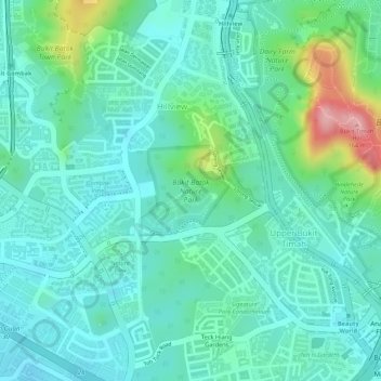
Nombre: Mapa topográfico Bukit Batok Nature Park, altitud, relieve.
Altitud media: 45 m
Altitud mínima: 5 m
Altitud máxima: 168 m
The peak of Bukit Batok Hill stands at an elevation of 107m above sea level. Temperature ranges from 23°C to 30°C during "Winter/Wet" season. During Summer, temperature ranges from 24°C to 33°C.
Otros mapas topográficos
Haga clic en un mapa para ver su topografía, su altitud y su relieve.