
Mapa topográfico Gilbertsville
Mapa interactivo
Haga clic en el mapa para ver la altitud.
Acerca de este mapa
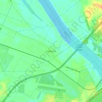
Nombre: Mapa topográfico Gilbertsville, altitud, relieve.
Lugar: Gilbertsville, Marshall County, Kentucky, United States (37.00450 -88.31976 37.04450 -88.27976)
Altitud media: 104 m
Altitud mínima: 92 m
Altitud máxima: 128 m
Otros mapas topográficos
Haga clic en un mapa para ver su topografía, su altitud y su relieve.
Scale
United States > Kentucky > Marshall County
Scale, Marshall County, Kentucky, 42025, United States
Altitud media: 129 m
Marshall County
United States > Kentucky > Marshall County
Marshall County, Kentucky, United States
Altitud media: 126 m