
Haz una donación
Mapa topográfico Irving
Haga clic en el mapa para ver la altitud.
Haz una donación
Irving
Irving is a hamlet in Chautauqua County, New York, United States. (It also falls in Cattaraugus County and Erie County. The Cattaraugus County part of Irving is part of the Seneca Nation Native American territory, the Erie County part borders Brant, New York and also is part of the Seneca Nation territory. ) It is located near the eastern town line and the eastern county line in the town of Hanover. U.S. Route 20 and New York State Route 5 pass through the hamlet, which is next to Cattaraugus Creek; New York State Route 438 terminates just across the creek. The elevation of the hamlet is 584 feet (178 m) above sea level. The ZIP Code for Irving is 14081.
Haz una donación
Acerca de este mapa
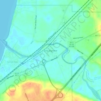
Nombre: Mapa topográfico Irving, altitud, relieve.
Altitud media: 185 m
Altitud mínima: 172 m
Altitud máxima: 216 m
Haz una donación
Otros mapas topográficos
Haga clic en un mapa para ver su topografía, su altitud y su relieve.
Chautauqua Lake
United States > New York > Chautauqua County > Bemus Point
Chautauqua Lake, at an elevation of 1,308 feet (399 m) above sea level, is higher than any of the Finger Lakes. It is also one of the highest navigable lakes in North America. The lake's water level is regulated by Warner Dam, with the water level lifted during the summer to allow for recreational boat use and…
Altitud media: 463 m
Haz una donación
Village of Cassadaga
United States > New York > Chautauqua County > Town of Stockton
Cassadaga is located on the northwestern edge of the Allegheny Plateau in western New York at 42°20'29" north, 79°18'56" west (42.341343, -79.315653) at an elevation of approximately 1,340 feet (410 m) above sea level. The village is located at the south end of Lower Cassadaga Lake, Lily Dale being located…
Altitud media: 418 m
Haz una donación
Haz una donación
Haz una donación
Village of Celoron
United States > New York > Chautauqua County > Town of Ellicott
Altitud media: 410 m
Haz una donación
Haz una donación