
Gracias por apoyar a este sitio ❤️
Haz una donación
Haz una donación
Mapa topográfico Clarksville
Haga clic en el mapa para ver la altitud.
Gracias por apoyar a este sitio ❤️
Haz una donación
Haz una donación
Acerca de este mapa
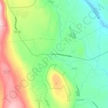
Nombre: Mapa topográfico Clarksville, altitud, relieve.
Altitud media: 243 m
Altitud mínima: 110 m
Altitud máxima: 456 m
Gracias por apoyar a este sitio ❤️
Haz una donación
Haz una donación
Otros mapas topográficos
Haga clic en un mapa para ver su topografía, su altitud y su relieve.
John Boyd Thacher State Park
United States > New York > Albany County > Town of New Scotland
The escarpment features rocks of the Upper Silurian and Upper and Middle Ordovician ages resting below the Devonian rocks. At the base of the escarpment, the Schenectady beds are visible. The Rondout "waterlime" or dolomite overlies the Schenectady beds and is most pronounced below Minelot Falls. The…
Altitud media: 262 m