
Mapa topográfico Salinas
Mapa interactivo
Haga clic en el mapa para ver la altitud.
Acerca de este mapa
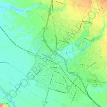
Nombre: Mapa topográfico Salinas, altitud, relieve.
Altitud media: 19 m
Altitud mínima: -2 m
Altitud máxima: 61 m
Prior to mass agricultural and urban development, much of the city consisted of rolling hills bisected by wooded creeks and interspersed with marsh land. Today, the city is located mostly on leveled ground, with some rolling hills and wooded gulches with creeks remaining in the north-eastern Creekbridge and Williams Ranch neighborhoods, as well as the Laurel Heights section of East Salinas. The natural ecosystems accompanying the area's topography and environment have been recreated in Natividad Creek Park and adjacent Upper Carr Lake.