
Mapa topográfico Sioux County
Mapa interactivo
Haga clic en el mapa para ver la altitud.
Acerca de este mapa
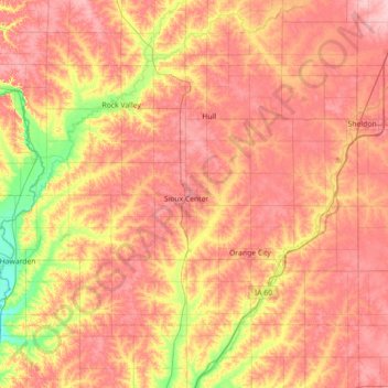
Nombre: Mapa topográfico Sioux County, altitud, relieve.
Lugar: Sioux County, Iowa, United States (42.90908 -96.57149 43.26003 -95.85839)
Altitud media: 418 m
Altitud mínima: 351 m
Altitud máxima: 466 m
Otros mapas topográficos
Haga clic en un mapa para ver su topografía, su altitud y su relieve.
Chatsworth
United States > Iowa > Sioux County > Chatsworth > Chatsworth
Chatsworth, Sioux County, Iowa, 51011, United States
Altitud media: 359 m
Chatsworth
United States > Iowa > Sioux County
Chatsworth, Sioux County, Iowa, 51011, United States
Altitud media: 357 m
Hawarden
United States > Iowa > Sioux County
Hawarden, Sioux County, Iowa, United States
Altitud media: 365 m