
Mapa topográfico Bürgenstock
Mapa interactivo
Haga clic en el mapa para ver la altitud.
Acerca de este mapa
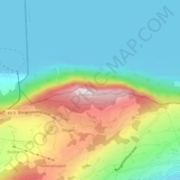
Nombre: Mapa topográfico Bürgenstock, altitud, relieve.
Lugar: Bürgenstock, Ennetbürgen, Nidwalden, 6373, Switzerland (47.00026 8.39828 47.00036 8.39838)
Altitud media: 641 m
Altitud mínima: 431 m
Altitud máxima: 1 096 m
On the Dufourkarte (Dufour Map), the topographic map of Switzerland from 1844 to 1864, the mountain ridge as a whole had no name. The highest crest was referred to as Hametschwand.