
Haz una donación
Mapa topográfico Loxahatchee Groves
Haga clic en el mapa para ver la altitud.
Haz una donación
Loxahatchee Groves
The area now known as Loxahatchee Groves was originally a portion of the 2,000,000 acres (8,100 km2) of land purchased by the Southern States Land and Timber Company in 1902. After the West Palm Beach Canal (C-51), which connected Lake Okeechobee at Canal Point to West Palm Beach, was completed in 1917, George Frederick Bensel, the Southern States sales manager, envisioned a "waterfront" farming community along the canal. Bensel, and company engineer Torvald Garfield "T. G." Thorgesen, created the first topographical map of Loxahatchee Groves during the following three years. Bensel, Thorgesen, and others then established the Palm Beach Loxahatchee Company, and bought 6,500 acres (26 km2) from the Southern States Land and Timber Company, naming the land "Loxahatchee Farms". The Palm Beach Loxahatchee Company built almost 30 mi (48 km) of canals and roads, which were to be maintained by the Loxahatchee Groves Drainage District, that now is known as the Loxahatchee Groves Water Control District.
Haz una donación
Acerca de este mapa
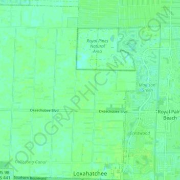
Nombre: Mapa topográfico Loxahatchee Groves, altitud, relieve.
Altitud media: 9 m
Altitud mínima: 4 m
Altitud máxima: 12 m
Haz una donación
Otros mapas topográficos
Haga clic en un mapa para ver su topografía, su altitud y su relieve.
Haz una donación
Haz una donación
Haz una donación
Loxahatchee Groves
United States > Florida > Palm Beach County > Loxahatchee Groves
Altitud media: 9 m
Caribbean Key
United States > Florida > Palm Beach County > Boca Raton > Caribbean Key
Altitud media: 5 m
Haz una donación
Morikami Museum and Japanese Gardens
United States > Florida > Palm Beach County > Delray Beach
Altitud media: 9 m