
Gracias por apoyar a este sitio ❤️
Haz una donación
Haz una donación
Mapa topográfico Taungoo
Haga clic en el mapa para ver la altitud.
Gracias por apoyar a este sitio ❤️
Haz una donación
Haz una donación
Taungoo
Three mountain ranges traverse the district—the Pegu Yomas, the Karen Hills, and the Nat Ma Taung or "Great Watershed"—all of which have a north and south direction, and are covered for the most part with dense forest. The Pegu Yomas have a general elevation of from 800 to 1,200 feet (240 to 370 m), while the central range averages from 2,000 to 3,000 feet (610 to 910 m). The rest of Taungoo forms the upper portion of the valley of the Sittaung River.
Gracias por apoyar a este sitio ❤️
Haz una donación
Haz una donación
Acerca de este mapa
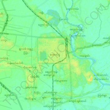
Nombre: Mapa topográfico Taungoo, altitud, relieve.
Lugar: Taungoo, Taungoo Township, Taungoo District, 08101, Myanmar (18.90021 96.39328 18.98021 96.47328)
Altitud media: 47 m
Altitud mínima: 38 m
Altitud máxima: 62 m
Gracias por apoyar a este sitio ❤️
Haz una donación
Haz una donación