
Mapa topográfico The Herring Pools (Low tide only)
Mapa interactivo
Haga clic en el mapa para ver la altitud.
Acerca de este mapa
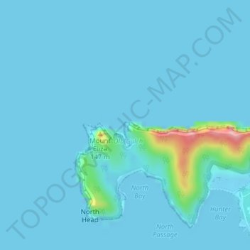
Nombre: Mapa topográfico The Herring Pools (Low tide only), altitud, relieve.
Altitud media: 12 m
Altitud mínima: -1 m
Altitud máxima: 178 m
Otros mapas topográficos
Haga clic en un mapa para ver su topografía, su altitud y su relieve.
Lord Howe Island
Australia > New South Wales > Lord Howe Island
Lord Howe Island, New South Wales, 2898, Australia
Altitud media: 27 m
Mount Gower
Australia > New South Wales > Lord Howe Island
Mount Gower, Lord Howe Island, New South Wales, 2898, Australia
Altitud media: 120 m