
Mapa topográfico Cuddalore
Mapa interactivo
Haga clic en el mapa para ver la altitud.
Cuddalore
Cuddalore is located at 11°45′N 79°45′E / 11.75°N 79.75°E / 11.75; 79.75. It has an average elevation of 6 m (20 ft). The land is completely flat with large black and alluvial soil inland and coarse sand near the seashore. The sandstone deposits in the town are popular. The Pennayar River runs north of the town, while Gadilam River runs across it. Cuddalore is situated at 200 km (120 mi) from the state capital Chennai and 18 km (11 mi) from Puducherry, the neighbouring union territory.
Acerca de este mapa
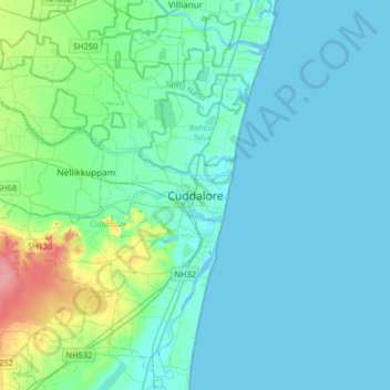
Nombre: Mapa topográfico Cuddalore, altitud, relieve.
Lugar: Cuddalore, Cuddalore District, Tamil Nadu, 607001, India (11.59643 79.60346 11.91643 79.92346)
Altitud media: 11 m
Altitud mínima: -4 m
Altitud máxima: 72 m