
Mapa topográfico Mörel-Filet
Mapa interactivo
Haga clic en el mapa para ver la altitud.
Acerca de este mapa
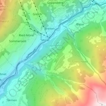
Nombre: Mapa topográfico Mörel-Filet, altitud, relieve.
Lugar: Mörel-Filet, Östlich Raron, Wallis, 3983, Switzerland (46.32583 8.02700 46.37278 8.09274)
Altitud media: 1 350 m
Altitud mínima: 694 m
Altitud máxima: 2 904 m
Otros mapas topográficos
Haga clic en un mapa para ver su topografía, su altitud y su relieve.
Mörel
Switzerland > Wallis > Östlich Raron > Mörel-Filet
Mörel, Mörel-Filet, Östlich Raron, Wallis, 3983, Switzerland
Altitud media: 1 244 m
Binntal
Switzerland > Wallis > Östlich Raron > Grengiols
Binntal, Grengiols, Östlich Raron, Wallis, 3993, Switzerland
Altitud media: 2 019 m