
Haz una donación
Mapa topográfico Florida City
Haga clic en el mapa para ver la altitud.
Haz una donación
Florida City
Florida City is situated mostly atop a limestone ridge called the Miami Rock Ridge that extends south from present day North Miami Beach to a location in Everglades National Park. The ridge, consisting of Miami limestone, serves as the higher ground within the community. The ridge extended from northeast to southwest across the city. The old location of the Florida East Coast Railway track marks the approximate boundary of the location of the limestone ridge south of Davis Parkway. The range of elevation of the ridge is from 5 to 8 feet (1.5–2.4 meters) above sea level.
Haz una donación
Acerca de este mapa
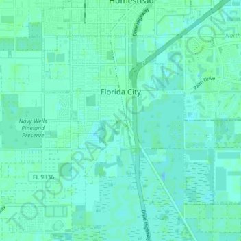
Nombre: Mapa topográfico Florida City, altitud, relieve.
Altitud media: 3 m
Altitud mínima: 0 m
Altitud máxima: 8 m
Haz una donación
Otros mapas topográficos
Haga clic en un mapa para ver su topografía, su altitud y su relieve.
Miami
United States > Florida > Miami-Dade County
Miami and its suburbs are located on a broad plain between the Everglades to the west and Biscayne Bay to the east, which extends from Lake Okeechobee southward to Florida Bay. The elevation of the area averages at around 6 ft (1.8 m) above sea level in most neighborhoods, especially near the coast. The…
Altitud media: 4 m
Haz una donación
Haz una donación
Alice C Wainwright Park
United States > Florida > Miami-Dade County > Miami > Brickell Hammock
Altitud media: 6 m
Haz una donación
Haz una donación
Haz una donación
Haz una donación
Haz una donación
Haz una donación
Haz una donación
Haz una donación
Sun-Tan Village
United States > Florida > Miami-Dade County > Hialeah > Sun-Tan Village
Altitud media: 7 m
Haz una donación
Tamiami
United States > Florida > Miami-Dade County > University Lakes Mobile Home Park
Altitud media: 6 m
Burke Recreation Center
United States > Florida > Miami-Dade County > Biscayne Park
Altitud media: 9 m
Pops Hammock Seminole Village
United States > Florida > Miami-Dade County > Pops Hammock Seminole Village
Altitud media: 3 m
Haz una donación
Hawley Heights
United States > Florida > Miami-Dade County > Kendall > Hawley Heights
Altitud media: 7 m
Haz una donación
Miami Heights Trailer Park
United States > Florida > Miami-Dade County > Miami Heights Trailer Park
Altitud media: 7 m
Haz una donación
South Miami Heights
United States > Florida > Miami-Dade County > South Miami Heights
Altitud media: 6 m
Haz una donación