
Haz una donación
Mapa topográfico Hseni
Haga clic en el mapa para ver la altitud.
Haz una donación
Hseni
The southern portion has much more flat land, along the, line of the Nam Tu, its tributaries the Nam Yao and the Nam Nim, and the Nam Yek flowing into the Salween. This was formerly densely populated, and still remains the most valuable portion of the state. A range running westwards from the Salween, and marking the southern border of the rift in the hills, divides North from South Theinni. Both north and south of the Nam Tu there are many peaks which rise to 6,000 feet (1,800 m), and several over 7,000 feet (2,100 m). The northern portion is almost consistent enough in its altitude of about 4,000 feet (1,200 m) to be called a plateau. It has large, grassy, upland downs. This part of the state has fallen almost entirely into the hands of the Kachins.
Haz una donación
Acerca de este mapa
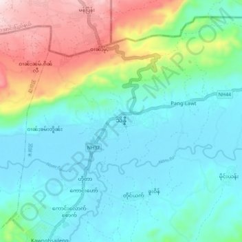
Nombre: Mapa topográfico Hseni, altitud, relieve.
Altitud media: 734 m
Altitud mínima: 602 m
Altitud máxima: 1 121 m
Haz una donación