
Mapa topográfico Cuneo
Mapa interactivo
Haga clic en el mapa para ver la altitud.
Acerca de este mapa
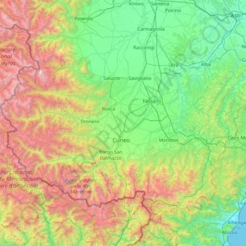
Nombre: Mapa topográfico Cuneo, altitud, relieve.
Lugar: Cuneo, Piamonte, Italia (44.05972 6.85451 44.85661 8.26921)
Altitud media: 1 021 m
Altitud mínima: 0 m
Altitud máxima: 3 790 m
Otros mapas topográficos
Haga clic en un mapa para ver su topografía, su altitud y su relieve.
Alpe Piantsola
Italia > Piamonte > Verbano-Cusio-Ossola > Antrona Schieranco > Antronapiana
Altitud media: 1 387 m