Geolocalizar

Mapa topográfico Jackson

Mapa interactivo

Haga clic en el mapa para ver la altitud.

Acerca de este mapa

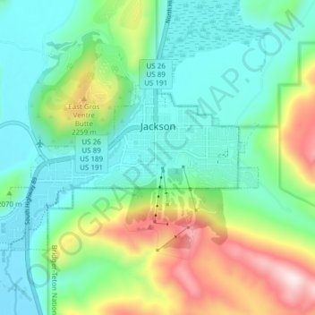
Nombre: Mapa topográfico Jackson, altitud, relieve.

Lugar: Jackson, Teton County, Wyoming, 83002, United States of America (43.45813 -110.81347 43.49046 -110.73764)

Altitud media: 2 043 m

Altitud mínima: 1 857 m

Altitud máxima: 2 511 m

Jackson is located at 43°28′31″N 110°46′9″W / 43.47528°N 110.76917°W / 43.47528; -110.76917 (43.475, −110.769), at an elevation of 6,237 feet (1,901 m) above sea level. According to the United States Census Bureau, the town has a total area of 2.95 square miles (7.64 km2), of which 2.91 square miles (7.54 km2) is land and 0.04 square miles (0.10 km2) is water.